Created by Jingqi Lu
Source ↗
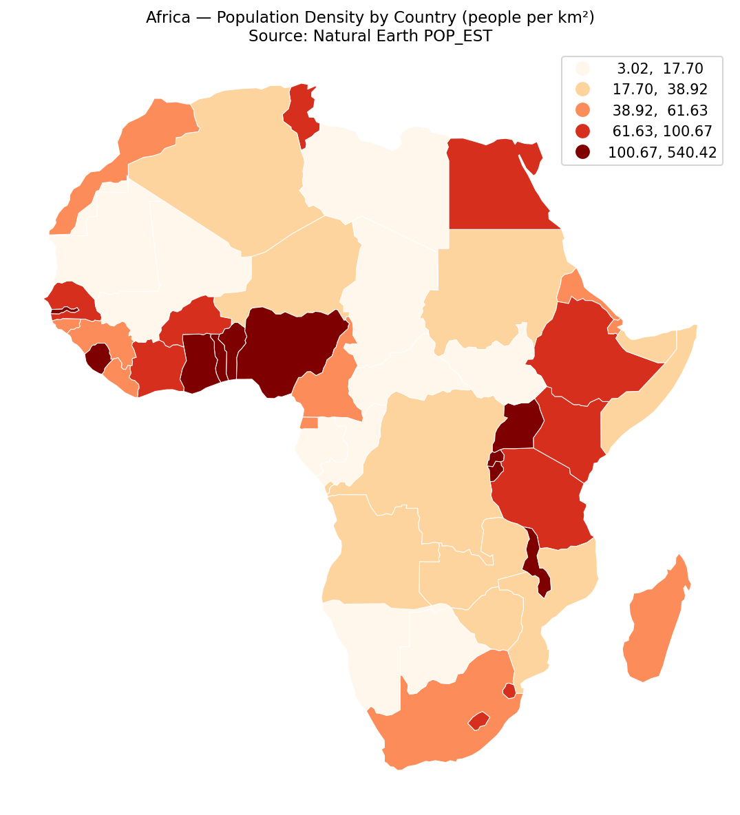
This sprint map shows population density by country across Africa.
Density is computed as POP_EST ÷ area_km², where areas are measured in an equal-area projection (EPSG:6933) to avoid distortion. Colors use a quantile scheme (5 classes) for quick legibility under the 10-minute constraint.
Cartography
- Basemap: country polygons with white borders for separation.
- Fill: choropleth by density (people/km²), legend on quantiles to balance extremes.
- Projection: EPSG:6933 (World Cylindrical Equal Area).
- Labels intentionally minimal to keep the focus on the density field.
Method (fast pipeline)1) Read Natural Earth Admin 0 via ZIP URL; filter CONTINENT == "Africa".
2) Reproject to EPSG:6933; compute area_km².
3) Calculate density = POP_EST / area_km²; map with 5-quantile classes.
4) Export as a compact PNG thumbnail for the challenge page.
Caveats: POP_EST is a national aggregate—great for speed, not for within-country patterns. For subnational detail, swap in gridded population (WorldPop/GHSL) when time allows.