Created by Jingqi Lu
Source ↗
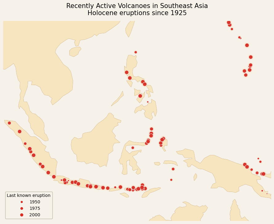
This sprint map shows recently active volcanoes across Southeast Asia, limited to Holocene volcanoes with eruptions recorded since 1925.
Each point is a volcano, with symbol size keyed to the recency of its last known eruption (1950, 1975, 2000 in the legend).
The pattern reveals the tight clustering of active systems along Indonesia’s volcanic arc, with additional chains in the Philippines and Mariana Islands. The map emphasises how densely the region’s major population centres sit along active plate boundaries.
Cartography
- Basemap: simplified land polygons for Southeast Asia in a warm, low-contrast tone; no borders or labels to keep focus on the arc geometry.
- Symbols: solid red circular markers for volcanoes, sized by last eruption year to hint at temporal intensity while keeping the palette minimal.
- Layout: a wide regional frame that captures the whole Sunda arc; a compact legend in the corner explaining eruption-year size classes; succinct two-line title highlighting both geography and time window.