Created by Jingqi Lu
Source ↗
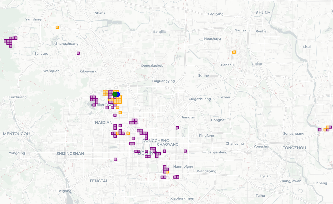
This map reconstructs the everyday activity space of a Beijing university student in 2008, using one year of GPS traces from the Geolife dataset.
The trajectories are collapsed to a grid of visited cells:
- Green dot marks the inferred home cell.
- Blue dot marks the university location.
- Orange squares are grid cells visited multiple times throughout the year.
- Purple squares are cells visited exactly once.
The pattern reveals a tight cluster of repeated activity around home and campus in Haidian, scattered one-off explorations spreading into central Beijing and out to the western hills, and a small satellite cluster in the eastern suburbs.
Cartography
- Basemap: light-toned OSM / CARTO streets and terrain to keep the focus on the student’s movements.
- Symbols: square grid cells derived from the GPS points, coloured by visit frequency; simple point markers for home and school to anchor the narrative.
- Layout: a wide city frame capturing both dense inner-city routines and sparse peripheral excursions, with legend labels phrased in everyday language (home, school, visited once, visited often).