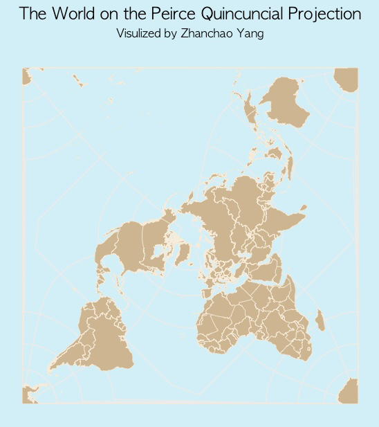
Day 19 (Projections): I created a world map using the Peirce quincuncial projection. The Peirce quincuncial projection is the conformal map projection from the sphere to an unfolded square dihedron, developed by Charles Sanders Peirce in 1877. Each octant projects onto an isosceles right triangle, with eight such triangles arranged into a square. The name quincuncial refers to this arrangement: the north pole at the center and quarters of the south pole in the corners form a quincunx pattern like the pips on the five faces of a traditional die. The projection has the distinctive property that it forms a seamless square tiling of the plane, conformal except at four singular points along the equator. (From Wikipedia)
Technical Implementation:
- rnaturalearth - R package for accessing Natural Earth vector map data at various scales
- sf - R package for handling spatial vector data and geometric operations
- ggplot2 - R’s powerful data visualization package for creating the map visualization
- tidyverse - Collection of R packages for data manipulation and visualization
Data Sources:
- Geographic Boundaries: Natural Earth - Medium-scale country boundaries accessed via the rnaturalearth package
- Projection: Peirce quincuncial projection with custom parameters (lon_0=25, shape=square)
Reference Map: