
Created by Thomas Hagos
Source ↗
A week of magnitude 4.5+ earthquakes, mapped as points. This saved USGS snapshot contains 135 epicenters dated October 26–November 2, 2026 (UTC). It is a Day 1 theme entry, not a map of earthquakes on November 1 alone.
Larger, warmer circles indicate higher magnitude. Circle area doubles per magnitude unit; it does not encode seismic energy. All snapshot events are shown using a plate carrée projection.
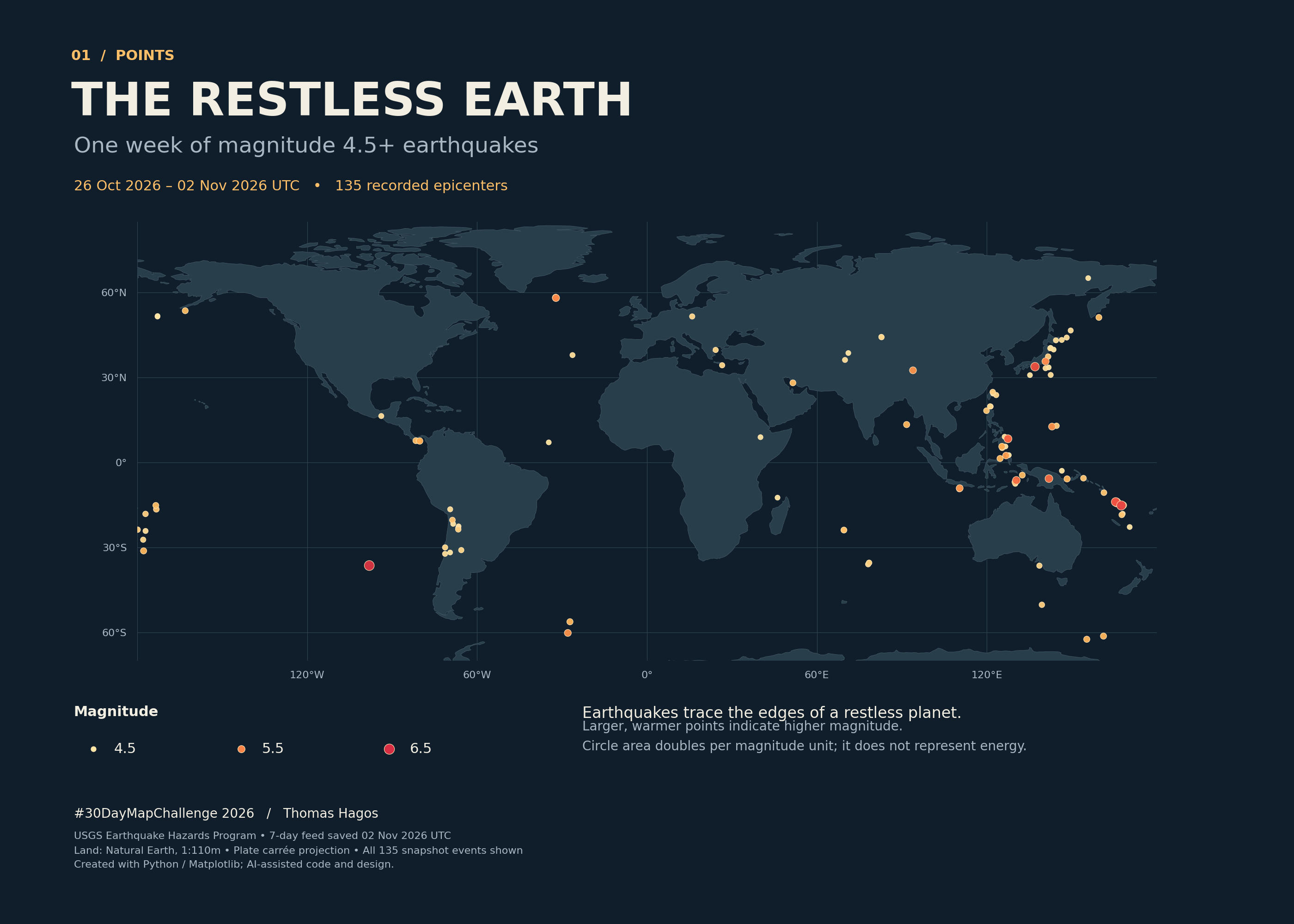
Data: USGS Earthquake Hazards Program, saved November 2, 2026. Land: Natural Earth, public domain. Python code, frozen input data, exact dependency versions and reproduction instructions are available in the source repository. AI assisted the code and initial cartographic design.