Created by Zhanchao Yang
Source ↗
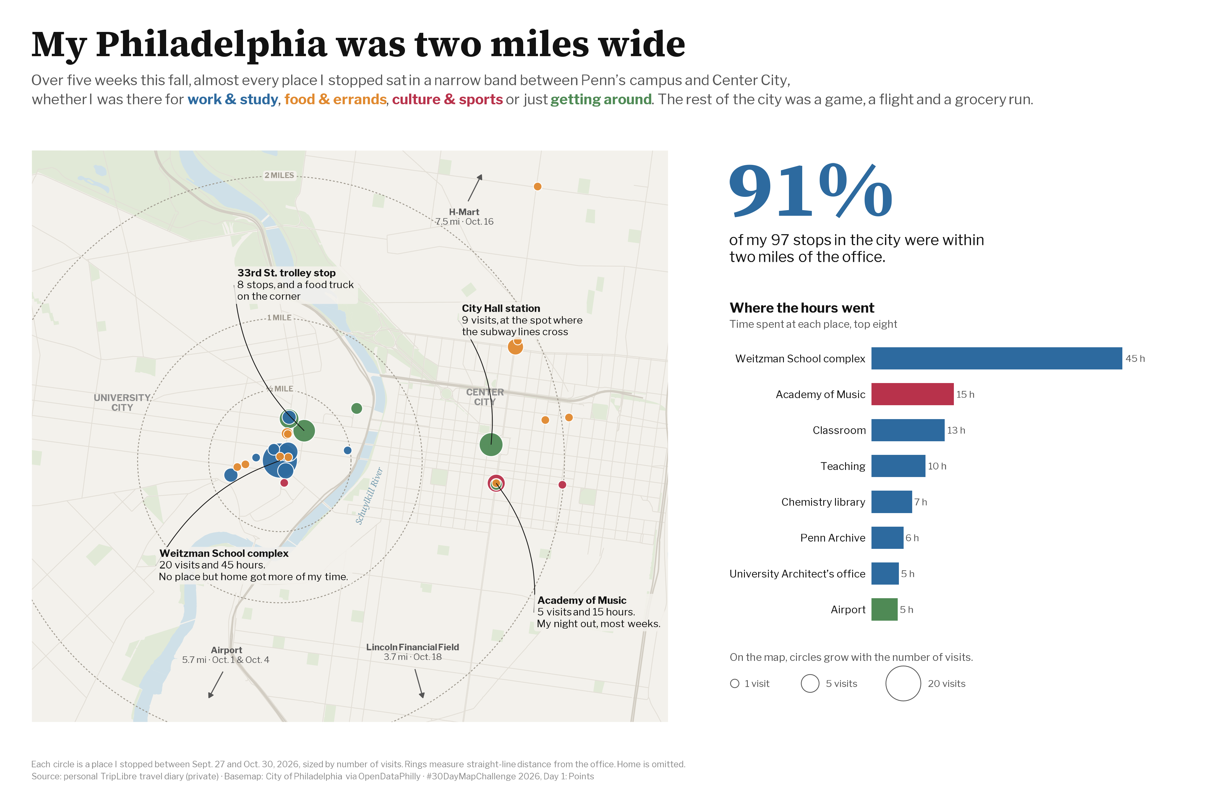
Day 1 (Points): This year, I’m building my #30DayMapChallenge around one dataset: my own everyday mobility, recorded with TripLibre, a local-first personal travel diary developed by myself. For Day 1, I mapped every place I stopped in Philadelphia between Sept. 27 and Oct. 30, 2026. Circles are sized by number of visits and colored by purpose: work & study, food & errands, culture & sports, and getting around.
Technical Implementation:
- R with
sf,dplyrandggplot2for spatial processing and mapping patchworkandggtextfor the map + chart layout and rich-text annotationsshowtextwith Libre Franklin and Source Serif 4 for typography- Data: personal TripLibre travel diary export (visits & places). The raw data stays private, and home is omitted from the map.
- Basemap: streets, parks, hydrology and city limits from the City of Philadelphia via OpenDataPhilly