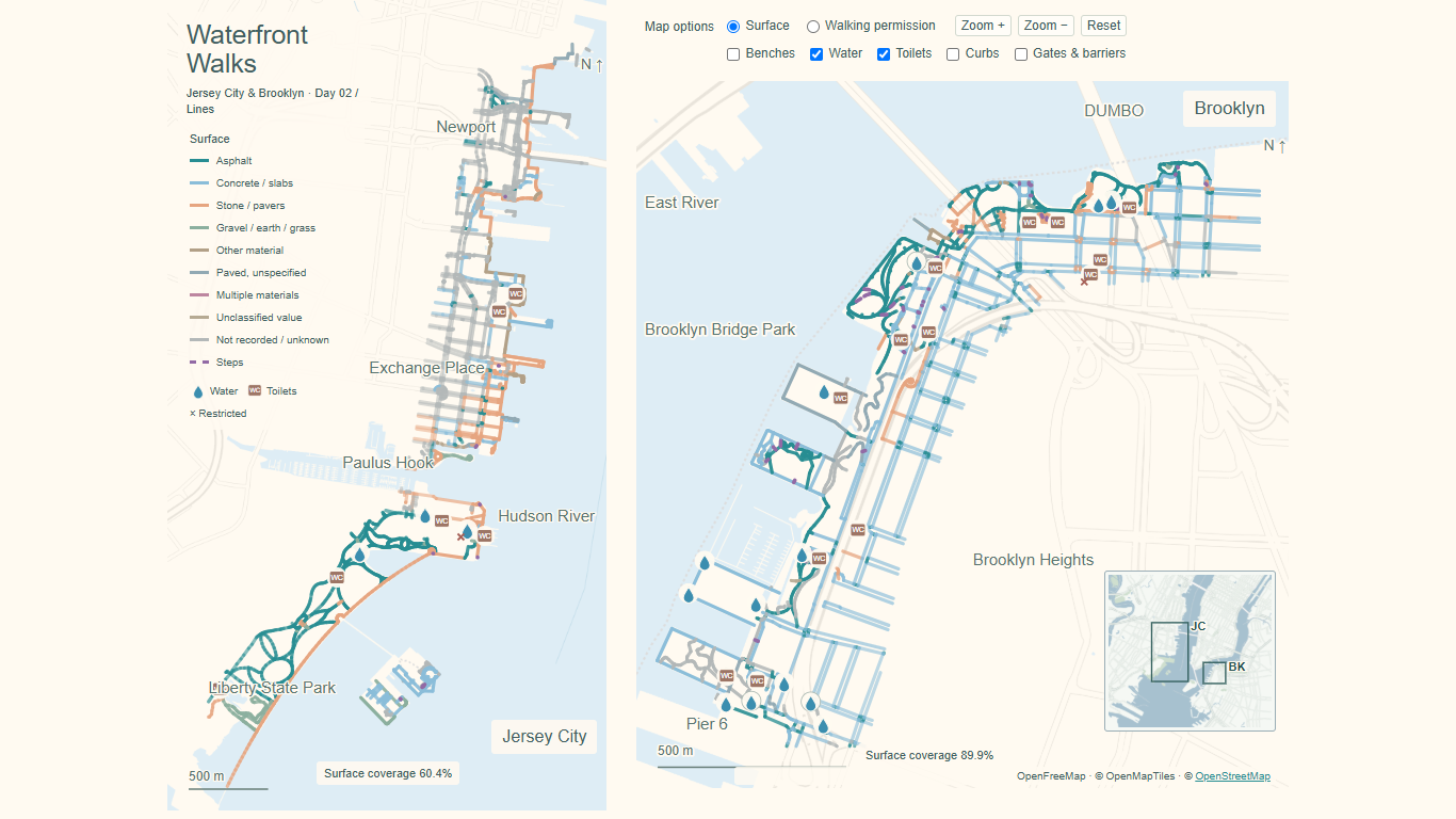
Day 2 (Lines): Pushing a stroller has made me notice how gravel paths and stairs can complicate a simple walk. I run into similar challenges when I wear high heels on a date. Inspired by these everyday experiences, this map explores recorded path surfaces and amenities along the Jersey City and Brooklyn waterfronts—because knowing what lies ahead can make a walk more enjoyable.
Waterfront Walks uses colored lines to distinguish recorded surface materials, including asphalt, concrete, stone, and gravel, with steps shown separately. Water and toilets appear by default; optional layers show benches, curbs, and gates/barriers. Readers can switch between surface materials and recorded walking permission, then inspect original OpenStreetMap tags. Missing records do not establish real-world absence, and recorded tags do not guarantee current conditions or access.
Technical implementation:
- Python for data processing and map generation; HTML, CSS, JavaScript, and SVG for the interactive map.
- Data: © OpenStreetMap contributors, acquired November 2, 2026, under ODbL 1.0.
- Basemap: OpenFreeMap, © OpenMapTiles and OpenStreetMap contributors.