Created by Zhanchao Yang
Source ↗
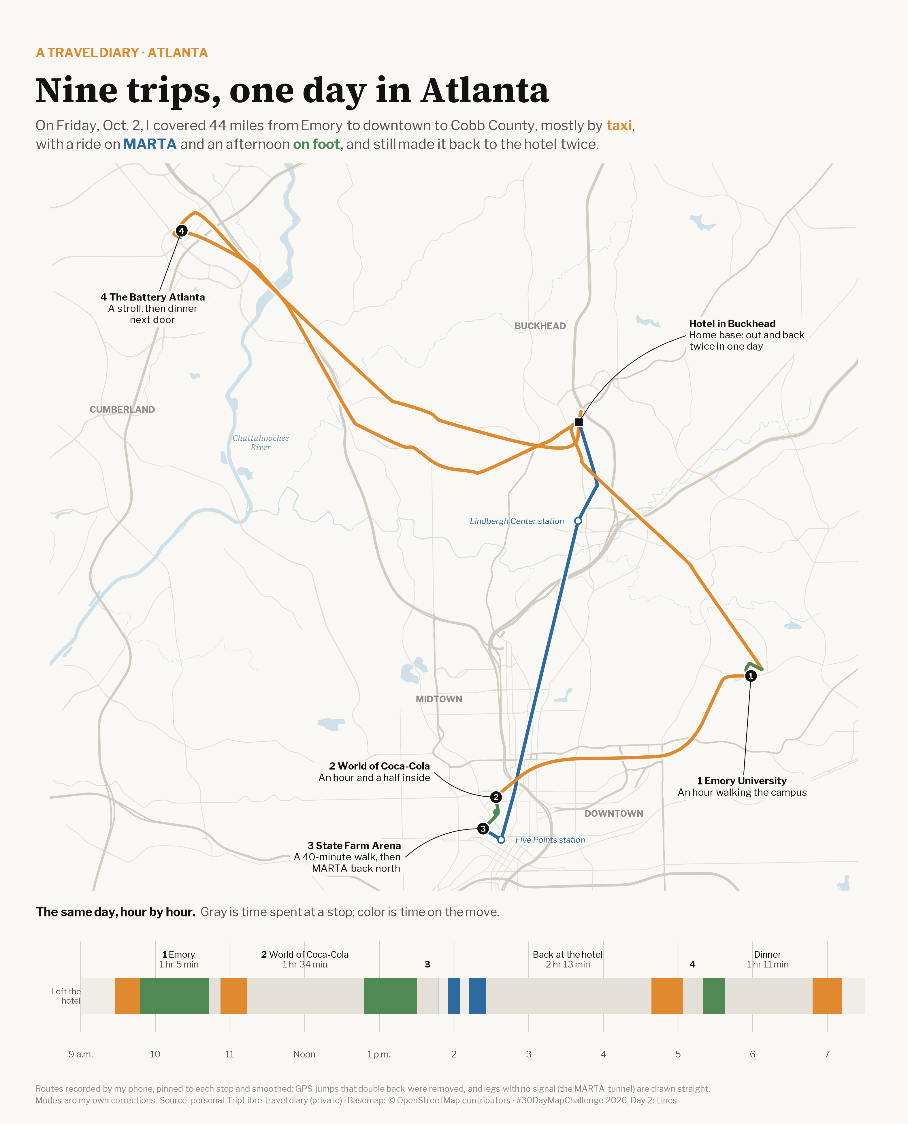
Day 2 (Lines): Continuing with my TripLibre travel diary, I mapped one full day of my Atlanta trip on Friday, Oct. 2, 2026. The map shows the nine trips I recorded, colored by mode: taxi, MARTA and on foot. Together they cover 44 miles from Emory to downtown to Cobb County, with two returns to the hotel in Buckhead. A timeline below the map lays out the same day hour by hour. Gray is time spent at a stop and color is time on the move.
Technical Implementation:
- R with
sf,dplyr,lubridateandggplot2for processing trips and drawing the map and timeline patchworkandggtextfor the map + timeline layout and rich-text annotationsshowtextwith Libre Franklin and Source Serif 4 for typography- Data: personal TripLibre travel diary export (trips & visits). Routes are pinned to each stop and smoothed. GPS jumps that double back were removed, and legs with no signal (the MARTA tunnel) are drawn straight. I corrected the travel modes by hand. The raw data stays private, and the hotel is labeled by neighborhood only.
- Basemap: roads and water from OpenStreetMap contributors via the Overpass API (
osmdata)