Created by Ming Cao
Source ↗
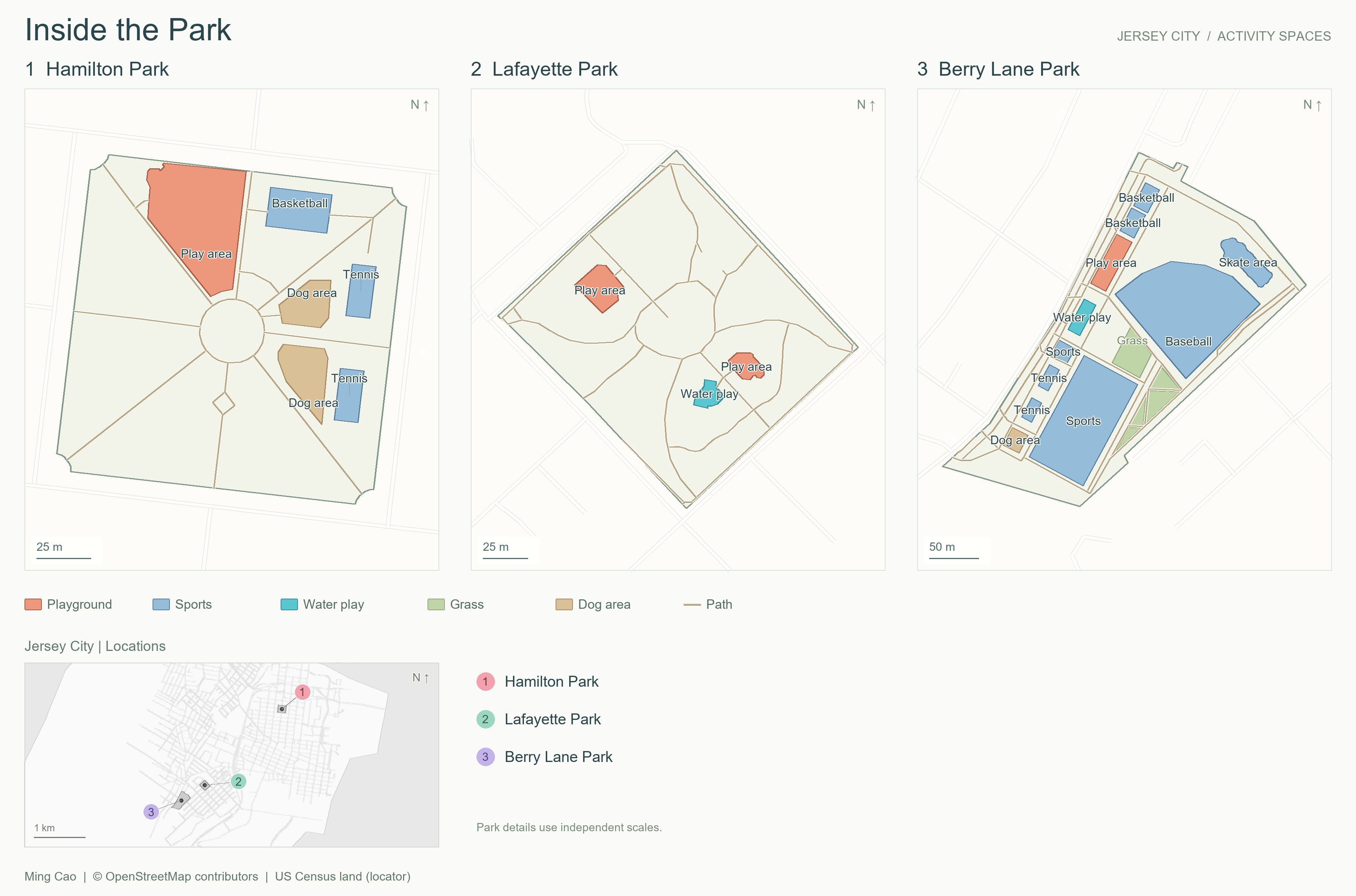
Day 3 (Polygons): Inside the Park explores the spaces within Hamilton Park, Lafayette Park, and Berry Lane Park in Jersey City. Colored polygons distinguish mapped playgrounds, sports areas, water play, grass, and dog areas, while paths connect the spaces. Each park has its own scale; a locator map shows their positions within the city. Unclassified areas and missing tags do not imply that activities or facilities are absent.
Data sources:
- Park boundaries, activity areas, paths, and streets: © OpenStreetMap contributors, reused from project caches, under ODbL 1.0.
- Locator-map land background: US Census Bureau, 2024 Cartographic Boundary Files, 1:500,000. Generalized boundaries are used for context.