
Two shores. One river. Different views.
I paired six public places along the New York–New Jersey Lower Hudson waterfront with dated photographs and aerial maps. The three pairings compare opposite skylines, a skyline and sunset, and two frames on the George Washington Bridge.
Explore the project · Code, sources and reproduction
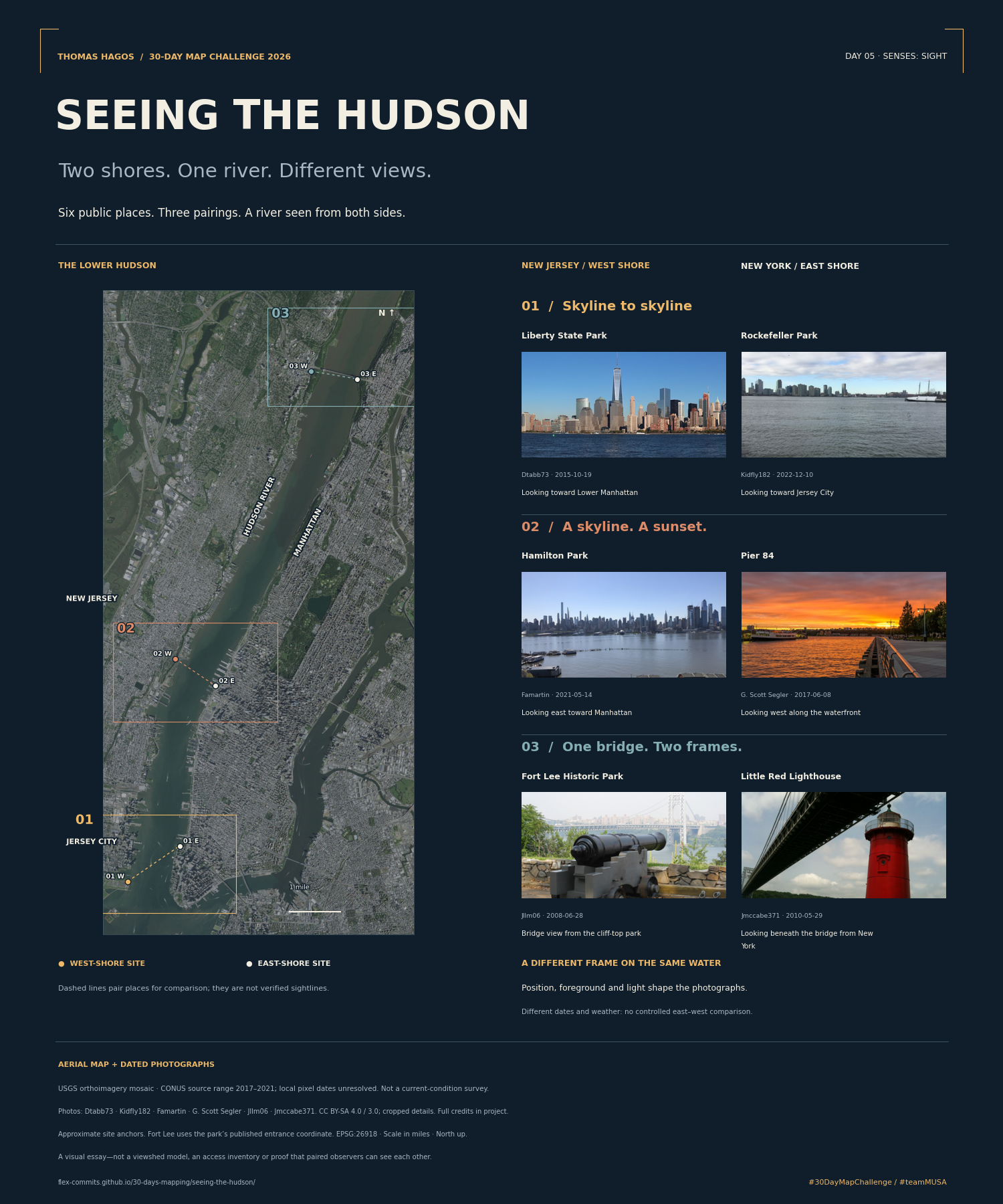
Dashed lines are editorial pairings, not verified sightlines. Photographs date from 2008–2022 and differ in conditions. USGS cached orthoimagery provides geographic context; exact local pixel acquisition dates are unresolved. No visibility model or current-access survey is claimed.
Cartography and text: Thomas Hagos. Photos: Dtabb73, Kidfly182, Famartin, G. Scott Segler, Jllm06 (CC BY-SA 4.0) and Jmccabe371 (CC BY-SA 3.0); original sources, dates, licenses and cropping are linked in the project. Poster composition CC BY-SA 4.0. Aerial imagery: USDA / USGS / The National Map. The aerial-only gallery thumbnail is CC BY 4.0.