
Day 6 (Vintage): In my previous heritage conservation work, I spent a lot of time aligning historical and modern maps to understand where a site was and how it had changed. This small mapping exercise draws on that experience.
For A Changing Harbor Edge, I overlaid modern land and shorelines on a historical chart of New York Harbor. I used four landmarks for an affine registration and kept a fifth landmark separate as an independent check. A light land tint and shoreline strokes allow the two periods to be read together while keeping the historical chart visible. The overlay helps me observe broad changes along the harbor edge; it is not intended for precise measurement of reclaimed land. The independent check showed an offset of about 92 meters, a reminder of the alignment’s limits.
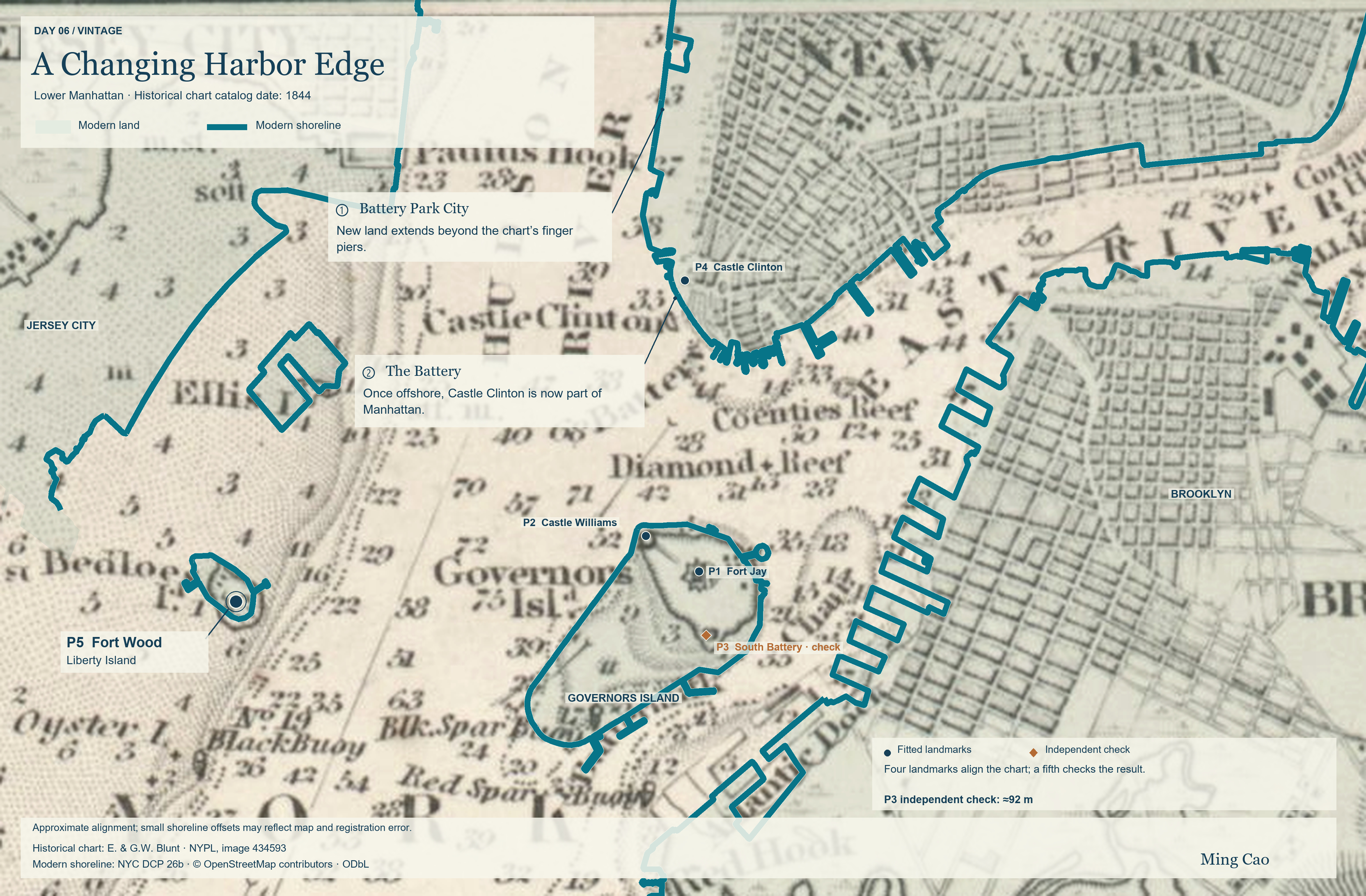
Data sources:
- Historical chart: E. & G.W. Blunt, New York Harbor and entrance: from the U.S. Coast Surveys, NYPL image 434593. NYPL lists the catalog date as 1844 (questionable); this is not a confirmed survey year. Public domain in the US.
- Modern land and shorelines: NYC DCP Borough Boundaries, version 26b, excluding water and OpenStreetMap contributors, ODbL 1.0. Jersey City data use retained snapshots, not a uniform survey date.
- Change annotations: Battery Park City Authority and NPS Castle Clinton foundation document.