
Old bends along the Lower Mississippi.
A river moves, but it doesn’t erase every trace. I mapped river and lake areas near Helena, Arkansas, and paired the new reference map with two credited details from the Mississippi River Commission’s 1938 Early Stream Channels sheet.
Explore the map · Code, source snapshots and methods
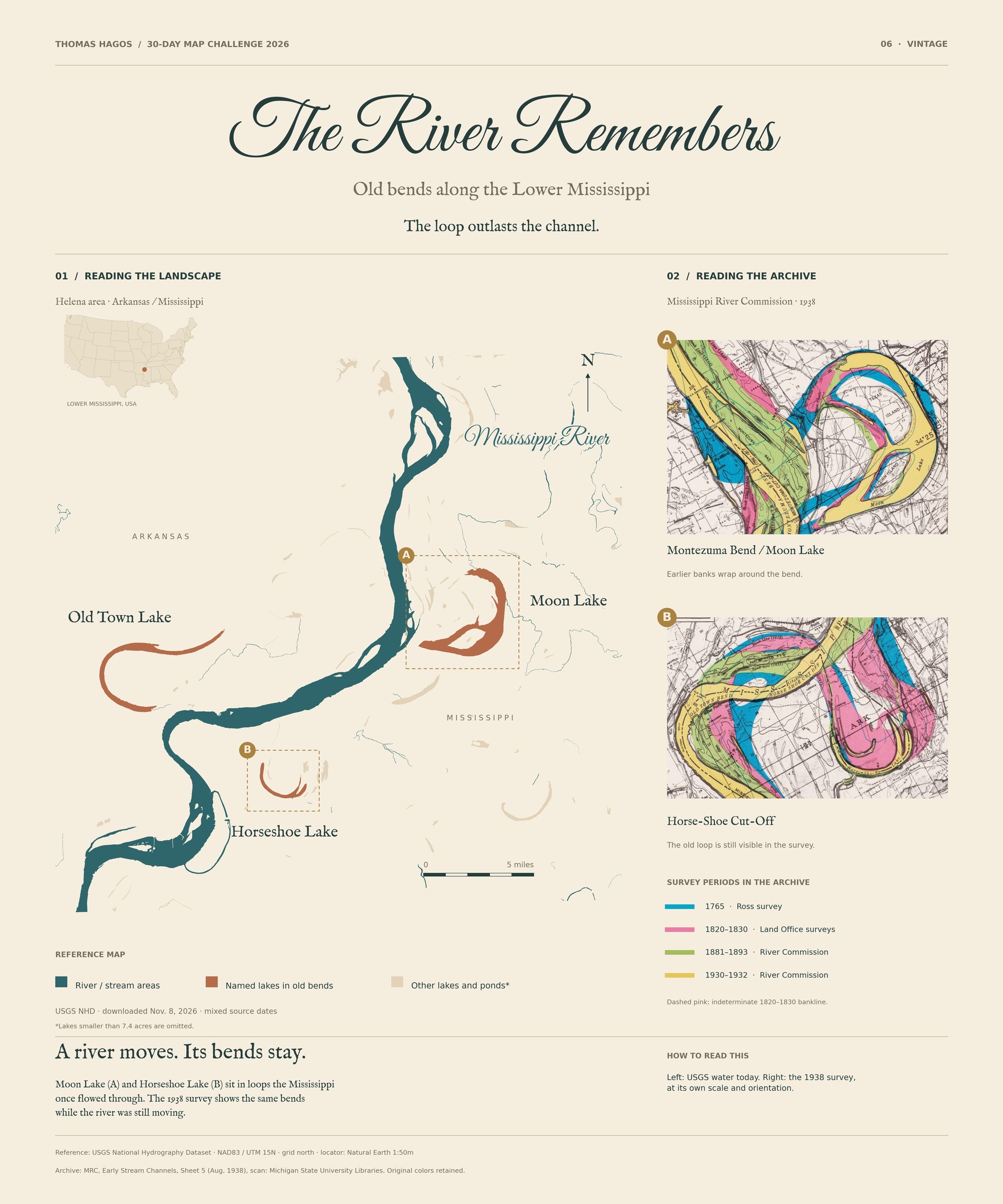
The reference map uses mixed-date USGS NHD geometry, downloaded November 8, 2026; the archival colors retain the original survey periods. The views have different scales and orientations and are not precisely registered. No migration rates, current-water-level survey or complete reconstructed historical channels are claimed.
Original reference cartography, design and text: Thomas Hagos, CC BY 4.0. Archival details: Mississippi River Commission, August 1938, Sheet 5; scan: Michigan State University Libraries. USGS data, federal source map and Natural Earth locator: public domain in the U.S. Font licenses and full source records are included in the project.