
Created by Ming Cao
Source ↗
Day 9 (Urban–Rural): Twenty leading surnames form a human geography of Taiwan through forty text labels. Type size reflects national household-registered surname populations as of 30 June 2023. Positions are adjusted for readability, and repeated labels mark selected local occurrences without representing additional people. Traditional surname forms and original place names are retained. NOAA ETOPO 2022 bathymetry gives the surrounding ocean its depth. This is an illustrated landscape of names, rather than a precise population-density map or a rigorous analysis of urban–rural differences.
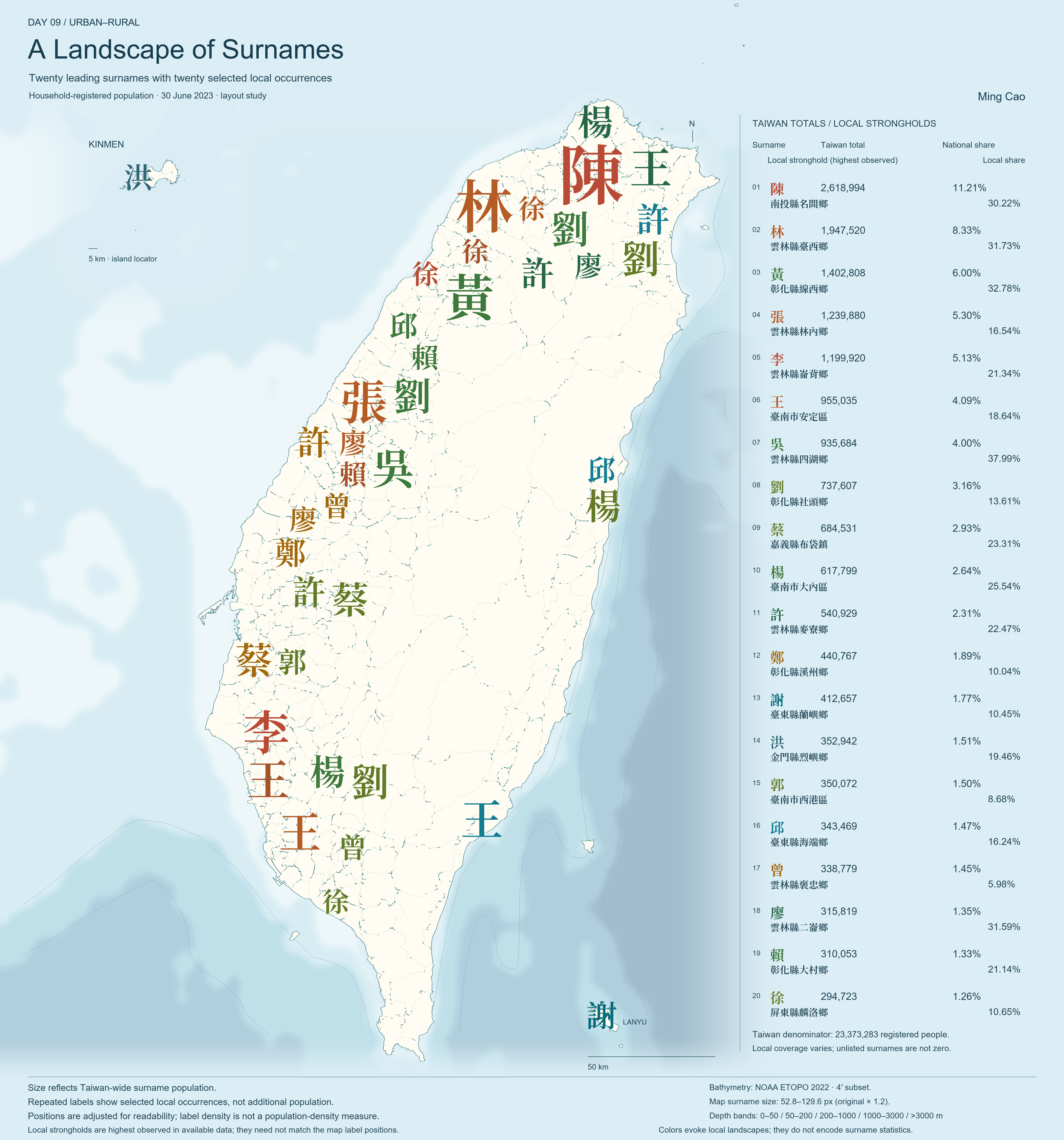
Data sources:
- Surname statistics: Taiwan Ministry of the Interior, Department of Household Registration, national surname counts, with local records documented in the project.
- Boundaries: National Land Surveying and Mapping Center, township boundaries. Government inputs: Open Government Data License, version 1.0.
- Ocean: NOAA NCEI, ETOPO 2022, generalized regional bathymetry.