
La Carte Infinie — Paris
| **Paris, France | Day 14 — A Borgesian Map** |
One city, infinite scales. / Une ville, mille échelles.
How does our understanding of a city change as we move between geographic scales?
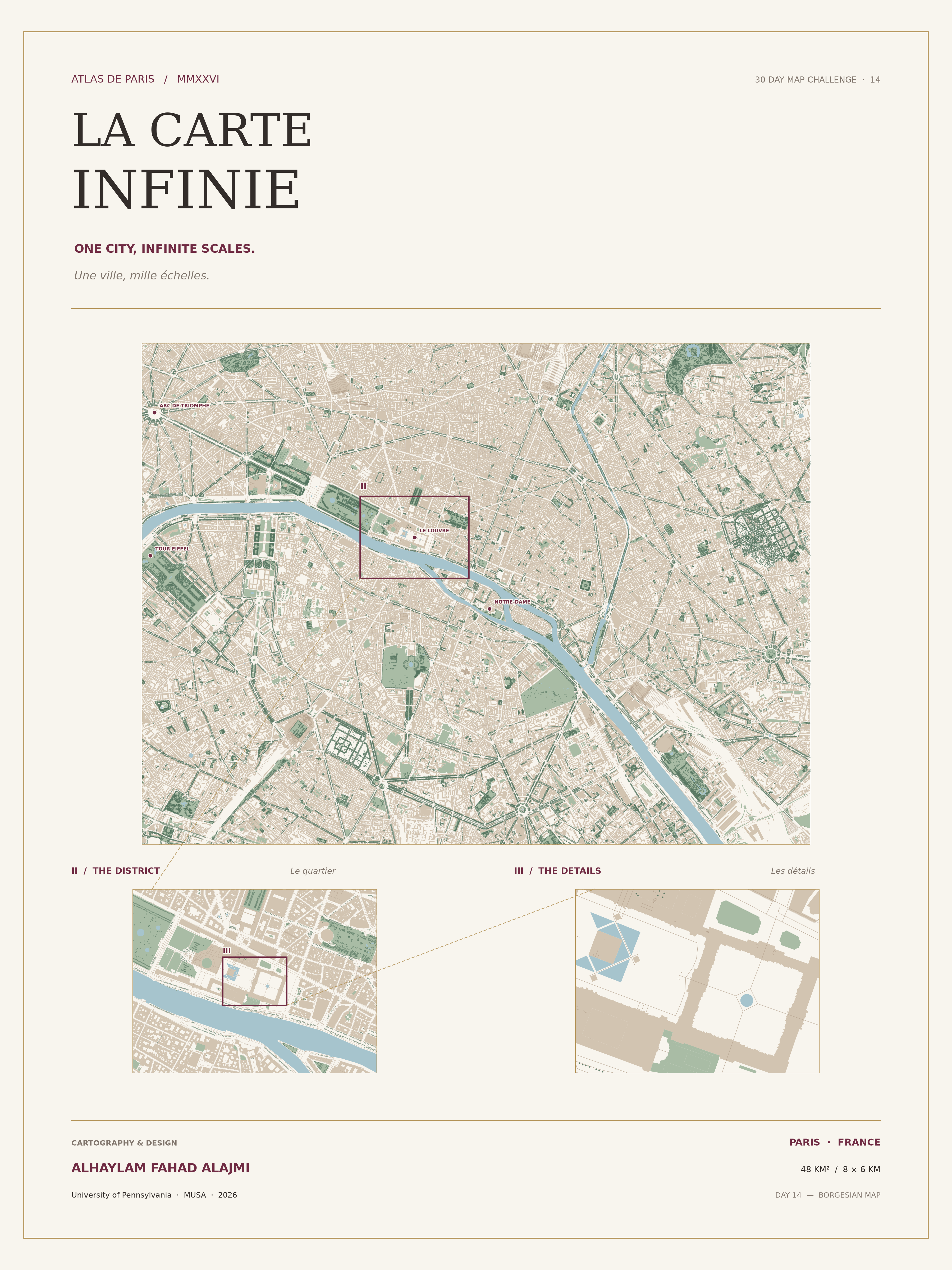
La Carte Infinie explores Paris through a multi-scale cartographic approach inspired by the concept of the Borgesian map. The project combines a detailed 2D atlas with an interactive 3D map to explore the relationship between the city, its neighborhoods, and individual urban features.
Explore the Interactive Map
The interactive experience includes 3D building representations, streets, the Seine River, parks, trees, selected landmarks, and bilingual information panels.
The Final Atlas
View the high-resolution poster (PDF)
Cartographic Approach
The atlas presents Paris at three connected scales:
- City scale: The broader Paris study area.
- District scale: A closer view of the Louvre neighborhood.
- Detail scale: Individual buildings, streets, and urban features.
The connected views illustrate how geographic detail changes with scale and how different representations can reveal new perspectives on the same urban environment.
Data and Tools
Data: © OpenStreetMap contributors.
Tools: Python, GeoPandas, Shapely, Matplotlib, MapLibre GL JS, and Jupyter Notebook.
Note: The 3D building heights are illustrative and should not be interpreted as measured heights.
Project Documentation
Explore the complete project, methodology, and Python notebook